World Map Archive
Hand-drawn maps from across the globe reveal regional and individual perceptions

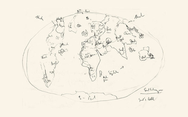
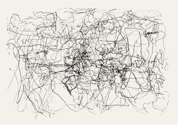
Picture a map of the world. Chances are, your country of residence is overwhelmingly large. If perspective and place are linked, Benjamin Pollach’s World Map Archive project is absolute proof. What started as a doodle on a napkin is now a full-fledged art project featuring first-try, no-peeking-at-Google, hand-drawn maps submitted from participants across the world. The results of Pollach’s crowd-sourced project will be on show beginning 1 June at The WYE in Berlin.
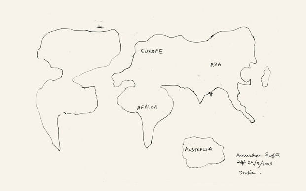
Pollach started by asking his friends to draw maps of the world without any reference material. They, in turn, asked their friends to participate and suddenly the project went global. Not long after, Pollach started to notice trends in regional perceptions.
“Almost every European draws Europe way too big in comparison to Africa and has no clue about Asia,” Pollach says. “Italy has to be in the map—no matter what,” he says of European participants. Meanwhile participants in India and Bangladesh draw Europe in little detail with the exception of the United Kingdom. This may reveal the role of colonial legacies in modern global perception.
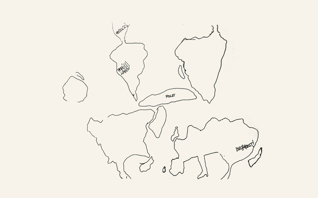
The World Map Archive is the first of its kind, whereby hand-drawn maps are sourced from across the globe. The project’s ultimate goal is to archive a map from every global citizen. Pollach believes this project illustrates the unique ways in which individuals across the world perceive themselves and their place in the larger context. The archive grows stronger with every submission and participating is easy. Click to download the template, follow the instructions and consider yourself part of the global project.
The World Map Archive is on display at The WYE from 1 June where you can also participate in the project. Keep an eye out for Pollach’s forthcoming book, which will feature high-quality prints of various maps submitted from an array of international participants. Proceeds will benefit education initiatives around the world.
Images courtesy of The World Map Archive